
When Your Bay Fishes Small
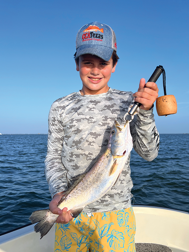
My clients and I left the marina very early this morning. In fact, we could barely see. It’s not my style to run across the bay in the dark but trout were getting harder to find and other fishermen were becoming overzealous. I was careful and I took it easy in the low light conditions. I didn’t care for it much but I wanted my customers to be able to experience the school of fish I’d been on. Apparently I’d left the dock too late as I noticed there was another guide anchored there as I got closer. I’d seen this movie before. It was time to find somewhere else to fish.
Galveston Bay is a little more than 600 square miles. It’s about 384,000 acres and is the largest bay in Texas and the seventh largest estuary in the United States. It’s relatively shallow, averaging only 7 feet deep and is surrounded by 232 miles of shoreline (“Galveston Bay 101”, gbep.texas.gov). Despite the fact that it’s a huge system it fishes really small at times. Just because there’s water doesn’t always mean there are fish in that water. Like most systems, there are many factors influencing how big or small the Galveston Bay Complex fishes. A thorough understanding of those factors and how to react will yield better results for us as anglers. Let’s dig deeper.
Habitat –
Some areas around the bay are making a comeback with regards to seagrass beds and oyster reefs but the majority of the areas that flourished with seagrass, oysters and clam beds are absent from where they were 20 years ago. Because of this fish are more concentrated in the areas with said habitat because of the marine life it supports. Barren mud flats have little to offer our target species that are in search of food and refuge. I use Google Earth to try to find reefs and grass beds in addition to online research through sites like the Texas Parks and Wildlife, Galveston Bay Foundation and the Nature Conservancy, just to name a few. I also pay close attention to where commercial oyster dealers are harvesting and transplanting live oysters on their private leases. Where there’s live habitat there will usually be fish. Once I’m in those areas I’ll look for signs such as slicks and/or bait concentrations, especially along reef edges, points, and grass lines. All serve as ambush points.
Seasonal changes –
As one would expect our trout pattern changes with the seasons. Fish spread out all over the bay during the summer months as water warms, forage species become plentiful and metabolism increases. There are usually lots of options early during the summer. There are still good numbers of trout on shorelines but open water reefs and structure come into play as well. Working birds over migrating shrimp can also be an option at times. This is typically the time of year when fishermen can spread out and still have a productive day on the water.
Towards the end of summer (mid-July through mid-September) our legal-sized trout here in the Galveston Bay Complex tend to concentrate in fewer areas. This is when I begin to notice boats I haven’t seen since the previous year. They are in search of areas with a better bite because their previous “spots” have dried up. This leaves me with basically two choices: I can leave the dock very early with hopes of beating someone to the “spot” or I can try to find another area or “spot” to fish. I typically do the latter which involves finding an area with similar structure and habitat that exhibits most of the same characteristics as the spot I lost to other boats. Many times my new spot isn’t quite as productive as my previous one but it’s usually good enough to get me and my clients on enough action until I can go back to the better spots later in the morning after other boats have left. There are also times when our trout will actually pull off the shell and get on top of the cool mud bottom nearby. Sometimes the sweet spot is no longer the sweet spot. When this happens, most anglers will just assume the fish are gone and they’ll go elsewhere.
The fall season is very similar to the late spring and early summer pattern in that most fish are still following bait migrations but are also beginning to stage near bayou drains and river mouths, especially in the wake of each passing cool front. Fish are still typically spread out enough to where we can find and catch trout and reds without having to deal with much boat traffic. This is especially true for those of us who pretty much choose not to work birds. These days, working birds usually results in catching a bunch of undersized fish and it’s simply not worth it. Not to mention you’re going to run the risk of unnecessarily killing trout you can’t retain. The exception is working birds over shallow reefs and/or in back lakes. Many times these schools will have legal sized trout and reds. The schools out in open water over mud are usually babies and undesirable species.
Then there’s the winter pattern. Colder water and lower tides tend to concentrate fish in and along guts, up bayous, and in nook and cranny areas. Many of our trout these days seem to concentrate more into neighborhood canals because of the warmer canal water, green (and white) lights that glow all night long, and abundant forage species. These areas are very easy to fish and are protected from the elements so they’ve become very popular. Because of this I tend to focus less on neighborhood canals and more on bayous, ditches and creeks with similar water depths, above average water temperatures and good concentrations of bait. There are plenty of areas like these throughout the complex if you do some digging.
Springtime trout tend to frequent coves and shorelines possessing some sort of habitat, especially near bayou drains. In this regard, the fish are somewhat concentrated not to mention the spring winds force us to wade tight to the shorelines. This limits the productive areas especially once others catch on to the patterns. Unfortunately, shorelines around the Galveston Bay Complex experience anywhere from 2 to 4.5 feet of erosion each year due to constant wave action, subsidence and other factors. On paper, our bay is getting bigger but from a fishing perspective the loss of shoreline habitat makes it fish smaller than it is. I’ve found that shorelines further back in the bay(s) have experienced fewer negative impacts from erosion, etc. It’s sometimes a longer run to get there but it gets me away from the more popular stretches of shoreline “community” spots.
Wind –
During the winter months wind speed and direction aren’t that big of a deal but during the warmer months when fish pull out of the bayous, rivers and deep backwater pockets, wind can become a problem. Our Achilles’ heel through the years seems to be that dreaded summertime southwest wind. There just aren’t many things we can do on a stiff wind out of that direction these days. Back in the “Good Ole Days” we could go to places like Half Moon Shoal and catch all we wanted. If we were wading then we could go to the Bolivar Pocket. Now things are different and there are fewer productive areas from which to choose.
As I type this the forecast for the next 4 days is predicting southwest winds 15-20mph. In my mind I’m already visualizing my possible fishing areas. I’ll probably also spend a little time looking at Google Earth. I’ll look at the predicted tide levels and whether I have drifting trips or wading trips. I will also take into consideration if other fishermen may frequent areas I’m considering and devise a back-up plan.
Freshwater Inflow –
Thank God we haven’t had to deal with heavier-than-normal inflows much this year but excessive freshwater run-off will concentrate fish in smaller areas. Not only do the fish concentrate but so do the boats. Ninety-five percent of the time you can find a similar area with suitable habitat and salinity but without the boat traffic. The NOAA OFS (Operational Forecast System) Salinity Nowcast hydrodynamic model shows the approximate salinity ranges for the bay system you choose (tidesandcurrents.noaa.gov). The very best method is to spend some time out on the bay assessing the situation for yourself, paying close attention to water clarity, bait concentrations and areas where saltwater becomes fresh and vice versa. There is also a distinguishable difference in the way salt and freshwater smells. Simply put, salt water smells like the beach and fresh water smells somewhat musty. Also, don’t forget to pay attention to your prop wash while idling. If you observe green water coming up from beneath the murky freshwater surface layer then you’re most likely in an area with good enough salinity levels to catch fish.
There will be times when it seems like there are fish on every street corner. Everyone will be catching and we won’t be able to wipe the smiles from our faces. Then one day the patterns drastically change because of one or more factors. The same number of boats will still be on the water but the productive areas will shrink to a fraction of what they were before. It may change for only one day because of a hard southwest wind or it could be for weeks because of a massive rainfall event. The smiles will fade and many will be left wondering what to do. Take the time to learn your fishing areas and what factors influence them, then keep your knowledge close to the vest. Use antidotal information and every tool available to develop a plan for success. Do this and you can keep smiling…even when your bay fishes small.